|
|
Louisiana's Disappearing Towns Collection
|
|
| |
|
|
|
April 25, 2024
Below are maps, studies, articles, and interactive graphics regarding Louisiana towns that are in danger of disappearing into the Gulf of Mexico. Some of these items also explore the hard choices that the state has to make about which communities to save—and which to let go.
|
|
| |
|
|
| |
NEWS STORIES
|
|
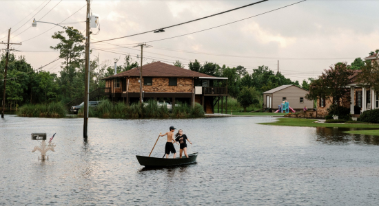
Photo: William Widmer/The New York Times
The New York Times: Left to Louisiana's tides, a village fights for time
"Louisiana’s 'working coast' is dotted with communities that, like Lafitte, may not outlast the people who currently live there: Cocodrie, Delacroix, Dulac, Grand Isle, Isle de Jean Charles, Kraemer, Leeville, Paradis, Pointe-aux-Chenes, Venice."
|
Read the NYT story 
|
|
|
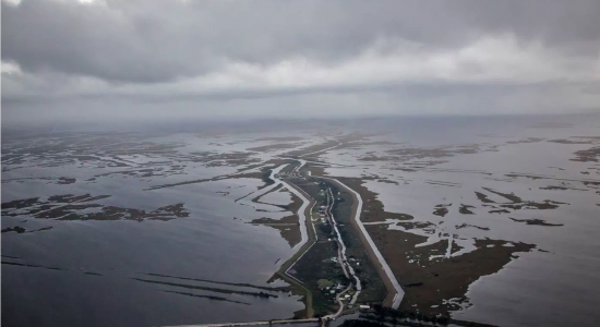
Photo: Julie Dermanski/Quartz
Quartz: The US is relocating an entire town
“I mean, heavens, if you can’t move 50 people, how do you move 100,000? And if you do successfully move 50, what does that tell you might be possible elsewhere?” —Mark Davis, Director, Tulane Institute on Water Resources Law and Policy
|
|
Read the Quartz story
|
| |
|
The Times-Picayune: State is buying Isle de Jean Charles relocation site for $11.7 million
|
|
| |
|
|
|
|
|
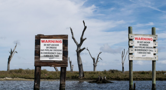
Eli Keene/National Geographic
National Geographic: Disappearing landscapes in Louisiana—when Google Maps can't catch up
"We stop at the town’s old cemetery, marked by a sole wooden cross...Although the Pointe Aux Chenes community still thrives up the bayou, it is eerie to traverse a landscape dotted with the carcasses of trees and imagine what was once here: a school building and houses; horses and cattle. A homeland."
|
|
Read the Nat Geo story
|
|
| |
|
|
| |
STUDIES, MAPS, INTERACTIVE GRAPHICS
|
|
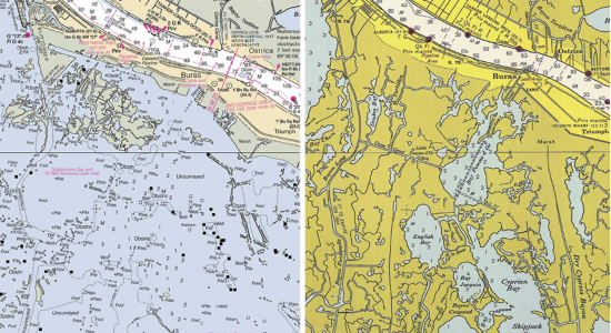
2012 and 1965 maps of Buras, Louisiana
NOAA: Geographic names disappear from charts, but not from history
NOAA's historical map and chart collection tool allows users to compare today's shorelines with the same geographical sites as they appeared in the past.
|
|
Search NOAA's historical maps
|
|
|
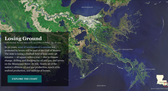
Photo: NASA/USGS Landsat
Pro Publica/The Lens: Losing ground
An award-winning reporting and interactive graphic project that explores the causes of Louisiana's land loss as well as the cultural, economic, and environmental costs of it.
|
|
Explore the Pro Publica/Lens project
|
|
|
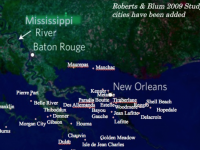
Blum & Roberts 2100 map: Louisiana's disappearing towns
|
|
| |
|
|
|
| |
|
Blum & Roberts: Drowning of the Mississippi delta
|
|
| |
|
|
|
![]()
|
Changing course: Navigating the future of the lower Mississippi delta
Competing science and engineering teams from around the world were tasked with developing 100-year visions for restoring and sustaining Louisiana’s eroding coast for the people, communities and industries in the region. All of the winning teams found that the state's southernmost communities should be abandoned.
|
|
Browse the project
|
|
|
NOAA
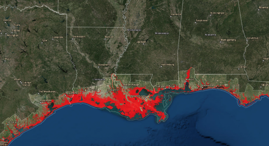
NOAA sea-level rise viewer
The National Oceanographic and Atmospheric Administration's sea-level rise viewer shows not only predicted sea-level rise, but also flood frequency, marsh migration, population vulnerability, and local scenarios.
|
|
Use interactive tool
|
|
| |
|
|
| |
RELATED ITEMS
|
|
Louisiana land loss collection
|
|
| |
|
|
|

|
|
Did oil and gas companies obey the law? A timeline
|
|
| |
|
|
|
|
|
|
|
|
|
|
|
